The problem
Deciding where to go in the morning means reading forecasts from more than one avalanche center — Chugach National Forest, Hatcher Pass, sometimes Valdez — and each publishes on its own site in its own format. Comparing them is manual, and the weather station data that would tell you whether the forecast still holds lives somewhere else entirely.
It is also the wrong task to be doing on a phone in a trailhead parking lot with one bar of service.
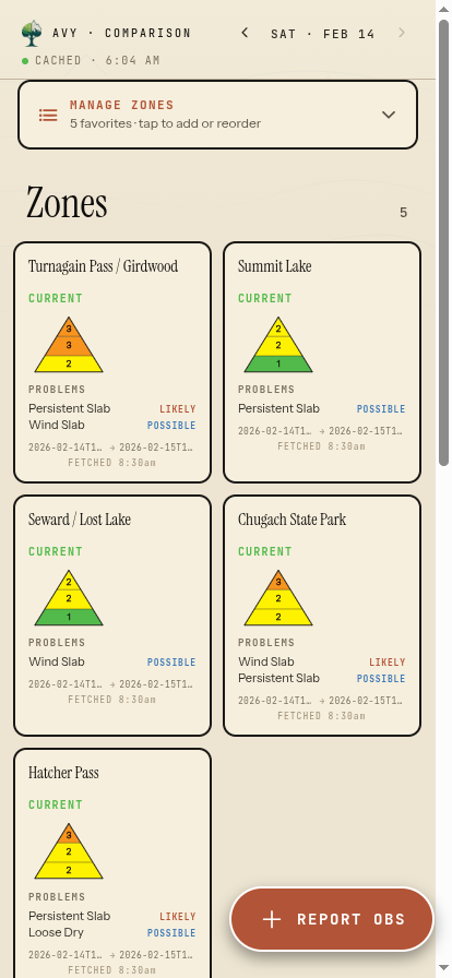
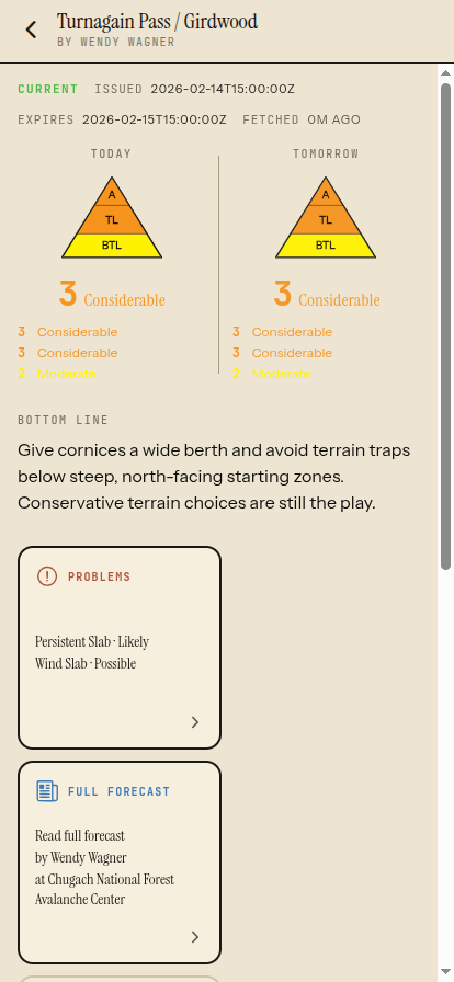
Captured out of season with representative mid-winter forecast data. Avalanche centers do not issue forecasts in July. The screens predate the rename and still show the old name, Avy Comparison.
What I built
A comparison view that puts every zone you care about on one screen, across avalanche centers, with the danger rose, the current avalanche problems, and their likelihood readable at a glance.
Zone detail that carries today and tomorrow's ratings by elevation band, the forecaster's bottom line, the full problem breakdown with aspects and elevations, and a link through to the original forecast — the app repackages public forecasts, it does not replace reading them.
Live SNOTEL station observations and NWS mountain weather folded in alongside the forecast, including temperature and wind sparklines, so the forecast can be checked against what the snowpack is actually doing.
An offline cache that keeps the last snapshot on the device, so the forecast is still there when service is not — plus observation submission straight into the National Avalanche Center's public API.
Where it landed
- Native iPhone app shipped through EAS Build to TestFlight
- Covers Alaska centers — Chugach, Hatcher Pass, Valdez, Cordova, Eastern Alaska Range, Coastal, Haines — alongside centers in the lower 48
- Shares one Supabase backend with the web version; the native port needed no backend changes
- Forecasts stay readable offline after the last sync
Built with
Got a problem shaped like one of these?